The weather over the North Sea will be characterized by alternating low- and high-pressure systems, creating slightly unsettled conditions. While the SW'ly flow will dominate, expect higher winds and waves in the Skagerrak region Wednesday night and ahead of Thursday’s trough.
What to expect?
A minor low-pressure area moves across the North Sea on Tuesday, quickly followed by a mobile ridge of high pressure midway this week. The region will be affected by a frontal trough on Thursday and Friday, which causes some uncertainty regarding the exact timing. High pressure gradually builds over the North in the course of the weekend.Skaggerak
In general, a large-scale SW’ly flow dominates the weather over the North Sea, but the highest winds are not expected to exceed fresh (around 20 knots) most of the time. However, Skagerrak will be shortly affected by near gale force NW’ly winds (around 30 knots) and waves up to 2-3m at the back of the minor low in the night to Wednesday.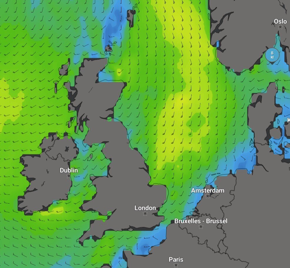 Wind for Thursday July 25, 18LT. Model: GFS
Ahead of Thursday’s trough, the southerly winds may shortly increase to strong (around 25 knots). The significant wave height is not expected to exceed 1 to 1.5m most of the time, often even below 1m.
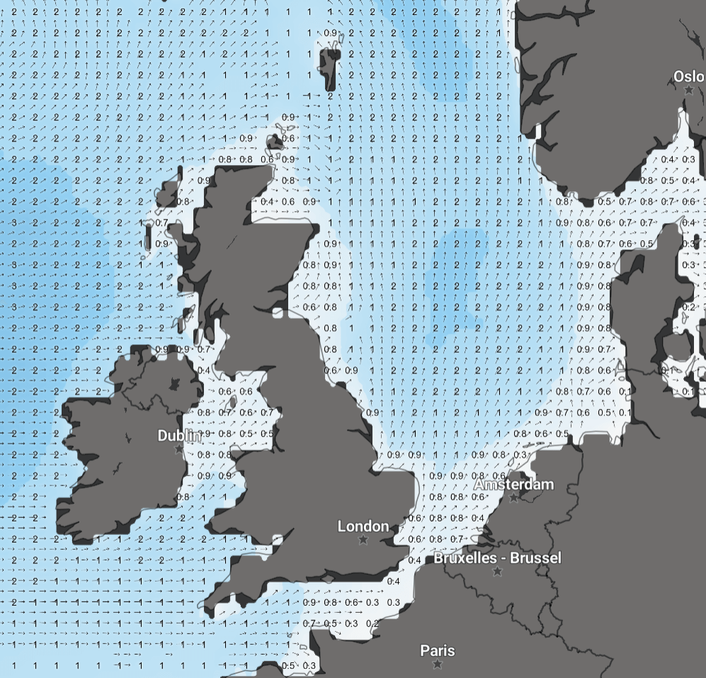 Waves for Thursday July 25, 18LT. Model: GFS
However, the possible enhanced southerly winds on Thursday may push the significant wave height up to 2 to 2.5m in the central and northern parts of the North Sea. Wind and waves will further calm down again during the weekend.
More updates and insights like this? Subscribe to our newsletter and receive the latest articles in your mail.