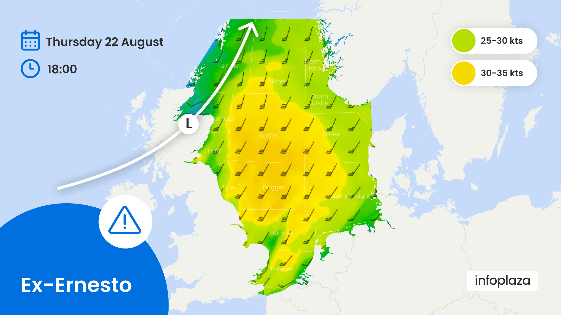
Steering low pressure continues to be present over the northern Atlantic near Iceland this week, associated troughs and disturbances affect the North Sea from time to time. Ex-hurricane Ernesto makes the move across the northern Atlantic and the remnants will most likely move across Ireland, Scotland and the northern North Sea on Thursday.
Just like last week, a west-southwesterly flow with unsettled weather conditions will dominate the weather over the North Sea, while high pressure can be found predominantly over the European mainland this week. Former hurricane Ernesto, currently located east of Newfoundland, is downgraded into a tropical storm and will rapidly move ENE across the Atlantic the coming days. It will further loose intensity as it follows a track across the cooler waters of the northern Atlantic. The remnants of Ernesto are expected to move NE across Ireland, Scotland and the northern North Sea on Thursday.
Increasing wind, waves building up
Strong W’ly winds (around 25kts) over the southern North Sea on Wednesday may push the waves up to 2.5m, while the northern North Sea will face much calmer conditions. After this relatively calm intermezzo over the central and northern North Sea on Wednesday, the SW’ly winds are expected to increase to near gale force (30-35kts) over the greatest part of the North Sea on Thursday as the remnants of Ernesto will pass. The associated waves can easily build to 3-4m later that same day. The SW’ly winds will gradually weaken on Friday and during the weekend, but at this stage it’s rather uncertain how fast or slow this will happen.
The W’ly winds transport relatively cool air into NW Europe, reducing the likelihood of reduced visibility due to fog this week. An occasional thunderstorm can’t be excluded in the vicinity of passing troughs, but no large scale activity is expected this week.